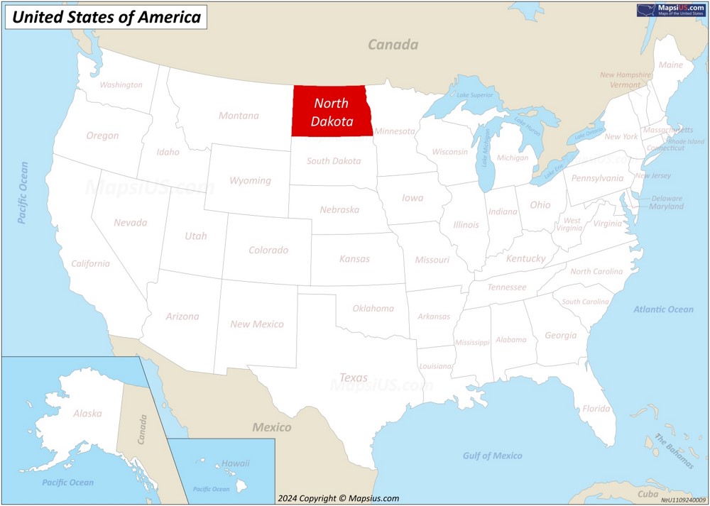
Map of North Dakota
The state of North Dakota is located in the Upper Midwest region of the United States. The state borders the Canadian provinces of Saskatchewan and Manitoba to the north, the U.S. states of Minnesota to the east, South Dakota to the south, and Montana to the west.
About the map:
This map of North Dakota State shows Canada–United States border, the state borders, states, state capital, lakes, county borders, counties, county seats and important cities.
County seats are indicated by a red circle, white circles indicate cities, and the capital of North Dakota is indicated by a star in the red circle. The larger the city in terms of population, the larger the circle on the map and the larger the font of the city name.
Attribution is required! You may download, print or use the above map for educational, personal and non-commercial purposes. You must place a hyperlink (to this page) with attribution next to the image you use.
North Dakota State Maps
Other Maps of North Dakota
North Dakota State Profile

The Great Seal of the State of North Dakota |

Flag of North Dakota |
| Capital: | Bismarck |
| Largest city: | Fargo |
| Largest metropolitan area: | Fargo |
| Largest county by population: | Cass County |
| Largest county by area: | McKenzie County |
| Area: | 70,706 sq mi (183,125 km2) |
| Population (2024): | 796,568[1] |
| Density: | 10.73/sq mi (4.13/km2) |
| Dimensions: |
|
| Latitude: | 45°56′ N to 49°00′ N |
| Longitude: | 96°33′ W to 104°03′ W |
| Elevation: |
|
| Official language: |
|
| Religion (2022):[2] |
|
| Racial/ethnic groups (2023):[1] |
|
| Median household income (2023): | $75,949[1] |
| USPS abbreviation: | ND |
| ISO 3166 code: | US-ND |
| Time zone: | Most of state: UTC−06:00 (Central) Summer (DST) UTC−05:00 (CDT) Southwest: UTC−07:00 (Mountain) Summer (DST) UTC−06:00 (MDT) |
| The Official Website of the State of North Dakota: | www.nd.gov |
About the State of North Dakota
North Dakota is a U.S. state in the upper Midwest region of the country. It occupies 70,706 square miles (183,125 square kilometers), making it the 19th largest state by area. North Dakota borders the Canadian provinces of Saskatchewan and Manitoba to the north, Minnesota to the east, South Dakota to the south, and Montana to the west.

The state has a population of approximately 796,568 (2024), ranking it 47th in population among U.S. states. Bismarck serves as the state capital, while Fargo constitutes the largest city with about 133,000 residents. Other major urban centers include Grand Forks and Minot.
North Dakota maintains a robust economy based primarily on agriculture, energy production, and services. The state ranks as a leading producer of spring wheat, durum wheat, canola, flaxseed, and honey. The discovery of the Bakken Formation transformed North Dakota into the second-largest oil-producing state in the nation, significantly boosting its economy since the early 2000s. This energy boom created thousands of jobs and attracted workers from across the country.
The state government operates with a low tax burden, maintaining one of the lowest unemployment rates in the United States. North Dakota also hosts several military installations, including Minot Air Force Base and Grand Forks Air Force Base, which contribute substantially to the local economy.
Tourism represents a growing sector of North Dakota's economy. The state attracts visitors to several notable attractions including Theodore Roosevelt National Park, which showcases the dramatic badlands landscape and wildlife of western North Dakota. The park commemorates the 26th president who ranched in the area during the 1880s.
Other significant tourist destinations include the International Peace Garden on the Canadian border, Fort Abraham Lincoln State Park near Mandan, and the National Buffalo Museum in Jamestown, which maintains a herd of albino bison. Lake Sakakawea, created by Garrison Dam on the Missouri River, offers extensive recreational opportunities including fishing, boating, and camping.
The North Dakota Heritage Center in Bismarck serves as the state's primary museum, housing extensive collections related to Native American cultures and pioneer settlement. The Scandinavian Heritage Park in Minot celebrates the state's significant Norwegian and Swedish heritage with authentic structures and exhibits.
Despite its northern location and sometimes harsh climate, North Dakota attracts visitors year-round for outdoor recreation, including hunting, fishing, hiking, and winter sports. The state maintains 13 state parks and recreation areas that showcase its diverse natural environments.
Brief History
North Dakota entered the Union as the 39th state on November 2, 1889, simultaneously with South Dakota. Indigenous peoples, including the Mandan, Hidatsa, Lakota, Dakota, and Ojibwe nations, inhabited the region for millennia before European contact, establishing complex agricultural societies along the Missouri River and nomadic cultures across the plains.
The Lewis and Clark expedition traversed the territory in 1804-1806, documenting the landscape and interacting with Native communities. European American settlement remained minimal until the 1870s, when the Northern Pacific Railway expanded westward through the territory. The federal government acquired land through treaties with Native nations, often under controversial circumstances, and opened territories for homesteading.
The Homestead Act of 1862 brought waves of immigrants, particularly from Scandinavia, Germany, and Eastern Europe. These settlers established farms across the prairie, transforming the grasslands into agricultural operations.
North Dakota's economy centered primarily on wheat production during its early statehood. The Non-Partisan League, founded in 1915, emerged as a powerful political force representing agricultural interests against eastern financial institutions. This organization established state-owned enterprises, including the Bank of North Dakota, which continues to operate as the nation's only state-owned bank.
The state faced significant challenges during the Great Depression and Dust Bowl years of the 1930s. Environmental devastation combined with economic collapse prompted population decline that continued for decades.
Oil discovery in the Williston Basin during the 1950s diversified the economy, though agriculture remained dominant. The early 21st century brought unprecedented growth when technological advances enabled extraction from the Bakken formation, creating an oil boom that dramatically increased population and economic activity in western North Dakota.
Major cities in North Dakota
- Fargo
- Bismarck
- Grand Forks
- Minot
- West Fargo
- Williston
- Dickinson
- Mandan
- Jamestown
- Wahpeton
- Devils Lake
- Valley City
- Horace
- Watford City
- Lincoln
- Grafton
- Beulah
- New Town
- Casselton
- Rugby
Counties in North Dakota
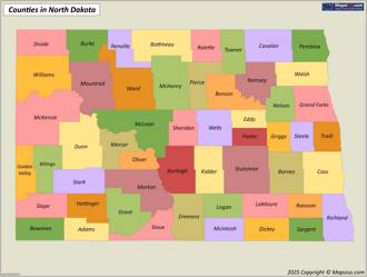
There are 53 counties in the U.S. state of North Dakota.
List of counties in North DakotaNorth Dakota County Map

Geography of North Dakota
North Dakota occupies 70,706 square miles in the north-central United States, ranking 19th in size among all states. The state borders Minnesota to the east, South Dakota to the south, Montana to the west, and the Canadian provinces of Saskatchewan and Manitoba to the north. The Missouri River divides North Dakota into two distinct physiographic regions: the Great Plains in the west and the Central Lowlands in the east.
The topography of western North Dakota features rolling plateaus and rugged badlands. The southwestern corner contains the state's highest point, White Butte, at 3,506 feet above sea level. The eastern region presents a flatter landscape shaped by glacial activity during the Pleistocene epoch. The Red River Valley, forming the eastern border, includes the state's lowest elevation at 750 feet. This fertile valley once held glacial Lake Agassiz, which left behind highly productive soils that support extensive agriculture.
North Dakota's climate exhibits continental characteristics with extreme temperature variations. Winters bring severe cold, with January temperatures averaging 2°F to 17°F across the state. Summers turn warm to hot, with July averages ranging from 67°F to 73°F. The state receives modest precipitation, averaging 13 inches annually in the northwest to 22 inches in the southeast. Most precipitation falls during the growing season between April and September. Strong winds frequently sweep across the open landscape, intensifying winter cold and summer heat.
The Missouri River system drains approximately 60% of the state, while the Red River drains the eastern portion. North Dakota contains numerous lakes, most notably Devils Lake in the northeast, which fluctuates dramatically in size due to climate cycles. The state's natural vegetation transitions from tallgrass prairie in the east to mixed-grass and shortgrass prairie in the drier west. Woody vegetation primarily grows along waterways, with cottonwoods, willows, and ash trees dominating riparian zones.
Below you will find a list of the largest lakes and the longest rivers in North Dakota.
Major Rivers in North Dakota
- Missouri River - 2,341 mi (3,767 km)
- James River - 710 mi (1,143 km)
- Yellowstone River - 692 mi (1,114 km)
- Sheyenne River - 591 mi (951 km)
- Little Missouri River - 560 mi (901 km)
- Red River of the North - 550 mi (885 km)
- Souris River - 435 mi (700 km)
- Pembina River - 319 mi (513 km)
- Wild Rice River - 243 mi (391 km)
- Grand River - 200 mi (322 km)
- Heart River - 180 mi (290 km)
- Cannonball River - 135 mi (217 km)
- Maple River - 124 mi (200 km)
- Knife River - 120 mi (193 km)
- Goose River - 120 mi (193 km)
- Forest River - 100 mi (161 km)
- Cedar Creek - 80 mi (129 km)
- White Earth River - 80 mi (129 km)
- Park River - 76 mi (122 km)
- Little Muddy River - 74 mi (119 km)
Major Lakes in North Dakota
- Lake Sakakawea - 368,000 sq mi (953,116 km2)
- Devils Lake - 211,000 sq mi (546,487 km2)
- Stump Lake - 27,000 sq mi (69,930 km2)
- Lake Oahe - 23,500 sq mi (60,865 km2)
- Lake Darling - 9,600 sq mi (24,864 km2)
- Lake Ashtabula - 5,430 sq mi (14,064 km2)
- Jamestown Reservoir - 2,095 sq mi (5,426 km2)
- Patterson Lake - 1,192 sq mi (3,087 km2)
- Homme Reservoir - 1,130 sq mi (2,927 km2)
- Heart Butte Reservoir - 1,120 sq mi (2,901 km2)
- Alkaline Lake - 832 sq mi (2,155 km2)
- Pipestem Reservoir - 830 sq mi (2,150 km2)
- Bowman-Haley Reservoir - 790 sq mi (2,046 km2)
- Long Lake - 770 sq mi (1,994 km2)
- Blacktail Dam - 730 sq mi (1,891 km2)
- Cottonwood Lake - 680 sq mi (1,761 km2)
- Larson Lake - 640 sq mi (1,658 km2)
- Clearwater Lake - 615 sq mi (1,593 km2)
- Brush Lake - 590 sq mi (1,528 km2)
- Rice Lake - 570 sq mi (1,476 km2)
The Highest Mountains in North Dakota
- White Butte - 3,506 ft (1,069 m)
- Chalky Butte - 3,430 ft (1,045 m)
- Black Butte - 3,428 ft (1,045 m)
- Sentinel Butte - 3,430 ft (1,045 m)
- Pretty Butte - 3,366 ft (1,026 m)
- Tracy Mountain - 3,350 ft (1,021 m)
- Bullion Butte - 3,340 ft (1,018 m)
- Davis Butte - 3,310 ft (1,009 m)
- West Rainy Butte - 3,276 ft (999 m)
- East Rainy Butte - 3,260 ft (994 m)
- Flat Top Butte - 3,237 ft (987 m)
- Square Butte - 3,175 ft (968 m)
- Camel's Hump Butte - 3,145 ft (959 m)
- Grassy Butte - 3,112 ft (948 m)
- Killdeer Mountains - 3,089 ft (942 m)
- Little Badlands Butte - 3,050 ft (930 m)
- Heart Butte - 2,980 ft (908 m)
- Blue Butte - 2,950 ft (899 m)
- Antelope Butte - 2,915 ft (889 m)
- Flattop Mountain - 2,890 ft (881 m)
Page Navigation
References
1. ^ QuickFacts North Dakota. U.S. Census Bureau.2. ^ "American Values Atlas: Religious Tradition in North Dakota". Public Religion Research Institute.


