Map of Hawaii
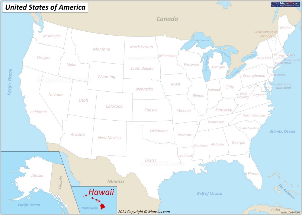
The state of Hawaii is located in the the Pacific Ocean about 2,000 miles (3,200 km) southwest of the U.S. mainland. One of the two non-contiguous U.S. states (along with Alaska)
About the map:
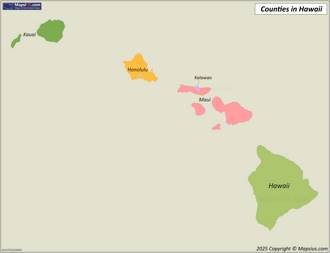
This map of Hawaii State shows islands, state capital, county borders, counties, county seats and important cities.
County seats are indicated by a red circle, white circles indicate cities, and the capital of Hawaii is indicated by a star in the red circle. The larger the city in terms of population, the larger the circle on the map and the larger the font of the city name.
Attribution is required! You may download, print or use the above map for educational, personal and non-commercial purposes. You must place a hyperlink (to this page) with attribution next to the image you use.
Hawaii State Maps
Other Maps of Hawaii
Hawaii State Profile

The Great Seal of the State of Hawaii |

Flag of Hawaii |
| Capital: | Honolulu |
| Largest city: | Honolulu |
| Largest county by population: | Honolulu County |
| Largest county by area: | Hawai'i County |
| Area: | 10,931 sq mi (28,311 km2) |
| Population (2024): | 1,446,146[1] |
| Density: | 221/sq mi (82.6/km2) |
| Dimensions: |
|
| Latitude: | 18°55′ N to 28°27′ N |
| Longitude: | 154°48′ W to 178°22′ W |
| Elevation: |
|
| Official language: |
|
| Religion (2022):[2] |
|
| Racial/ethnic groups (2023):[1] |
|
| Median household income (2023): | $98,317[1] |
| USPS abbreviation: | HI |
| ISO 3166 code: | US-HI |
| Time zone: | UTC−10:00 (Hawaii) |
| The Official Website of the State of Hawaii: | ehawaii.gov |
About the State of Hawaii
Hawaii constitutes the 50th state of the United States, located in the central Pacific Ocean approximately 2,000 miles (3,200 km) southwest of the continental United States. The state encompasses nearly the entire Hawaiian archipelago, comprising 137 volcanic islands spanning 1,500 miles (2,400 km). Hawaii has a total land area of 6,423 square miles (16,638 km2), making it the 43rd largest state by area.
Hawaii does not border any countries, as it is an island state completely surrounded by the Pacific Ocean. The nearest continental landmass is North America.

The state capital is Honolulu, located on the island of Oahu. Other major cities include Hilo and Kailua-Kona on the Big Island (Hawaii Island), Kahului on Maui, and Lihue on Kauai. The state's population totals approximately 1.45 million residents, with nearly 350,000 living in Honolulu proper and about 1 million in the greater Honolulu metropolitan area.
Hawaii's economy relies primarily on tourism, defense, and agriculture. The state hosts over 10 million visitors annually, generating approximately $18 billion in tourism revenue. The U.S. military maintains significant installations across the islands, particularly on Oahu, including Pearl Harbor Naval Base and Schofield Barracks. Agricultural products include macadamia nuts, coffee, pineapple, livestock, and sugarcane, though the latter has declined significantly from its historical prominence.
Tourism dominates Hawaii's economic landscape, with visitors drawn to its tropical climate, beaches, and natural scenery. Major attractions include Waikiki Beach in Honolulu, Hawaii Volcanoes National Park on the Big Island, Haleakala National Park on Maui, and the Na Pali Coast on Kauai. Diamond Head, a volcanic tuff cone on Oahu, represents one of the state's most recognizable landmarks.
Hawaii maintains a unique political status as the only U.S. state that was formerly an independent monarchy. The state operates under a constitutional government with a governor as chief executive. The Hawaiian language holds official status alongside English, though English predominates in government and business.
The state faces several contemporary challenges, including high living costs, limited housing availability, and environmental pressures from tourism and development. Hawaii ranks among the most expensive U.S. states for housing and consumer goods, largely due to its geographic isolation and limited land availability.
Brief History
Polynesians from the Marquesas Islands first settled Hawaii around 300-600 CE, with later migrations from Tahiti. These settlers developed a complex society with distinct cultural practices, religious beliefs, and a strict kapu (taboo) system that governed Hawaiian life. Chiefs (ali'i) ruled different islands until King Kamehameha I unified the archipelago in 1810.
British explorer Captain James Cook arrived in 1778, marking Hawaii's first documented European contact. Cook named the islands the "Sandwich Islands." His arrival initiated profound changes as European and American traders, whalers, and missionaries arrived throughout the early 19th century. These newcomers introduced foreign diseases, decimating the native Hawaiian population from approximately 300,000 at contact to fewer than 40,000 by 1890.
The Hawaiian monarchy ruled from 1810 until 1893. King Kamehameha III established a constitutional monarchy in 1840. Later monarchs navigated increasing foreign influence and economic control by American sugar planters and businessmen. Queen Liliuokalani, Hawaii's last monarch, attempted to restore royal powers in 1893 but faced overthrow by American business interests with support from U.S. military forces.
American businessmen established a provisional government after the overthrow and sought annexation by the United States. Despite initial opposition from President Cleveland, the U.S. annexed Hawaii in 1898 during the Spanish-American War. Congress designated Hawaii as a U.S. territory, initiating further Americanization and militarization, particularly after the 1941 Japanese attack on Pearl Harbor.
Hawaii became the 50th U.S. state on August 21, 1959. The modern era has witnessed tourism replacing agriculture as the dominant economic sector, a Hawaiian cultural renaissance beginning in the 1970s, and ongoing discussions about Native Hawaiian sovereignty and reconciliation for historical injustices.
List of islands of Hawaii
| Island | Area | Population (2020) |
|---|---|---|
| Hawaiʻi | 4,028 sq mi (10,432.5 km2) | 200,629 |
| Maui | 727.2 sq mi (1,883.4 km2) | 164,221 |
| Oʻahu | 596.7 sq mi (1,545.4 km2) | 1,016,508 |
| Kauaʻi | 552.3 sq mi (1,430.5 km2) | 73,298 |
| Molokaʻi | 260 sq mi (673.4 km2) | 7,345 |
| Lānaʻi | 140.5 sq mi (363.9 km2) | 3,367 |
| Niʻihau | 69.5 sq mi (180 km2) | 84 |
| Kahoʻolawe | 44.6 sq mi (115.5 km2) | 0 |
Major cities in Hawaii
- Honolulu
- East Honolulu
- Pearl City
- Hilo
- Waipahu
- Kailua
- Kaneohe
- Kahului
- Mililani Town
- Ewa Gentry
- Kihei
- Kapolei
- Mililani Mauka
- Makakilo
- Kailua-Kona
- Wahiawa
- Wailuku
- Ewa Beach
- Halawa
- Ocean Pointe
Counties in Hawaii
There are 5 counties in the U.S. state of Hawaii.
List of counties in HawaiiHawaii County Map

Geography of Hawaii
Hawaii consists of 137 volcanic islands spanning 1,500 miles in the central Pacific Ocean. The archipelago originated from a mantle plume creating the Hawaiian-Emperor seamount chain. Eight main islands form the southeastern portion of the chain: Niihau, Kauai, Oahu, Molokai, Lanai, Kahoolawe, Maui, and Hawaii Island.
The state encompasses 10,931 square miles of land area, ranking 43rd among U.S. states. Topography varies dramatically across short distances. Mauna Kea on Hawaii Island reaches 13,796 feet above sea level, while nearby ocean trenches descend thousands of feet below. This extreme vertical relief creates diverse microclimates and ecosystems within minimal horizontal space.
Shield volcanoes dominate Hawaiian geology. Kilauea, located on Hawaii Island, ranks among Earth's most active volcanoes with continuous eruptions since 1983. Volcanic activity continually reshapes the landscape through new land creation and erosional processes.
Hawaii's isolation—2,390 miles from California—has produced extraordinary biodiversity with high endemism rates. The islands host over 1,000 native plant species with 90% occurring nowhere else on Earth. Human activity has significantly altered native ecosystems through species introductions and habitat modification.
Climate patterns reflect Hawaii's mid-ocean tropical location and mountainous terrain. The northeastern trade winds deliver moisture to windward slopes, creating rainforests receiving over 400 inches of annual precipitation. Leeward areas experience rain shadow effects with some regions receiving less than 10 inches yearly. The state maintains remarkably consistent temperatures year-round, averaging 70-85°F at sea level with approximately 7°F decrease per 1,000 feet of elevation gain. Seasonal variation manifests primarily through rainfall patterns rather than temperature fluctuations. October through April constitutes the wetter season, while May through September brings drier conditions.
Coastal geography features both dramatic sea cliffs exceeding 3,000 feet on Molokai's north shore and extensive white, black, and green sand beaches. Fringing coral reefs surround most islands, supporting diverse marine ecosystems and providing coastal protection.
Below you will find a list of the highest mountains and the longest rivers in Hawaii.
Major Rivers in Hawaii
- Kaukonahua Stream - 33 mi (53 km)
- Wailuku River - 28 mi (45 km)
- Wailua River - 20 mi (32 km)
- Hanalei River - 16 mi (26 km)
- Wainiha River - 13 mi (21 km)
- Waimea River - 12 mi (19 km)
- Anahulu River - 11 mi (18 km)
- Lumahai River - 11 mi (17 km)
- Honolii Stream - 10 mi (16 km)
- Waikele Stream - 10 mi (16 km)
- Hanapepe River - 8 mi (13 km)
- Waialua River - 8 mi (13 km)
- Iao Stream - 8 mi (12 km)
- Hakalau Stream - 7 mi (11 km)
- Waimanu Stream - 7 mi (11 km)
- Huleia River - 7 mi (11 km)
- Kohala Stream - 6 mi (10 km)
- Waikoloa Stream - 6 mi (10 km)
- Kalihi Stream - 6 mi (9 km)
- Kawainui Stream - 5 mi (8 km)
20 Highest Mountains in Hawaii
- Mauna Kea - 13,803 ft (4,207 m)
- Mauna Loa - 13,679 ft (4,169 m)
- Haleakala - 10,023 ft (3,055 m)
- Hualalai - 8,271 ft (2,521 m)
- Pu'u Kukui - 5,788 ft (1,764 m)
- Kaunu o Kaleihoohie - 5,505 ft (1,678 m)
- Kawaikini - 5,243 ft (1,598 m)
- Wai'ale'ale - 5,148 ft (1,569 m)
- Kamakou - 4,961 ft (1,512 m)
- Lanaihale - 3,366 ft (1,026 m)
- Mount Paniau - 3,320 ft (1,012 m)
- Puu Alii - 3,117 ft (950 m)
- Puu Kolekole - 3,107 ft (947 m)
- Ka'ala - 4,025 ft (1,227 m)
- Pu'u 'Ō'ō - 3,608 ft (1,100 m)
- Pu'u Wa'awa'a - 3,967 ft (1,209 m)
- Pu'u Pane - 2,707 ft (825 m)
- Pu'u Kukui - 2,667 ft (813 m)
- Pu'u o Kona - 2,610 ft (796 m)
- Kilohana - 2,484 ft (757 m)
Page Navigation
References
1. ^ QuickFacts Hawaii. U.S. Census Bureau.2. ^ "American Values Atlas: Religious Tradition in Hawaii". Public Religion Research Institute.


