Map of Georgia
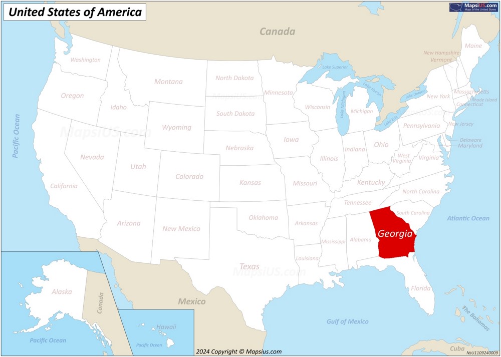
The state of Georgia is located in the Southeastern United States. Georgia is bordered by Tennessee and North Carolina to the north, South Carolina and the Atlantic Ocean to the east, Florida to the south, and Alabama to the west.
About the map:
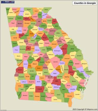
This map of Georgia State shows the state borders, states, state capital, islands, county borders, counties, county seats and important cities.
County seats are indicated by a red circle, white circles indicate cities, and the capital of Georgia is indicated by a star in the red circle. The larger the city in terms of population, the larger the circle on the map and the larger the font of the city name.
Attribution is required! You may download, print or use the above map for educational, personal and non-commercial purposes. You must place a hyperlink (to this page) with attribution next to the image you use.
Georgia State Maps
Other Maps of Georgia
Georgia State Profile

The Great Seal of the State of Georgia |

Flag of Georgia |
| Capital: | Atlanta |
| Largest city: | Atlanta |
| Largest metropolitan area: | Atlanta |
| Largest county by population: | Fulton |
| Largest county by area: | Ware |
| Area: | 59,425 sq mi (153,909 km2) |
| Population (2024): | 11,180,878[1] |
| Density: | 185.2/sq mi (71.5/km2) |
| Dimensions: |
|
| Latitude: | 30°31' N to 35°0' N |
| Longitude: | 81°0' W to 85°53' W |
| Elevation: |
|
| Official language: |
|
| Religion (2014): |
|
| Racial/ethnic groups (2024):[1] |
|
| Median household income (2023): | $74,664[1] |
| USPS abbreviation: | GA |
| ISO 3166 code: | US-GA |
| Time zone: | UTC−05:00 (Eastern) Summer (DST) UTC−04:00 (EDT) |
| The Official Website of the State of Georgia: | georgia.gov |
About the State of Georgia
Georgia is a state in the southeastern United States. It borders Tennessee and North Carolina to the north, South Carolina to the northeast, Florida to the south, and Alabama to the west. The state covers an area of 59,425 square miles (153,909 square kilometers), making it the 24th largest state by total area.

Atlanta serves as the state capital and largest city, with a metropolitan population exceeding 6.1 million residents. Other major cities include Augusta, Columbus, Macon, and Savannah. The state's total population reaches approximately 11.2 million (2024 estimate), ranking as the 8th most populous state in the nation.
Georgia maintains a diverse economy with significant sectors including agriculture, manufacturing, and services. Atlanta hosts the headquarters of major corporations like Coca-Cola, Home Depot, and Delta Air Lines. The state leads in the production of peanuts, pecans, and peaches, earning it the nickname "Peach State." The Port of Savannah represents one of the largest container ports on the East Coast.
The state's infrastructure includes Hartsfield-Jackson Atlanta International Airport, consistently ranking as the world's busiest airport by passenger traffic. Georgia's educational system features prominent institutions like the University of Georgia, Georgia Institute of Technology, and Emory University.
Tourism plays a vital role in Georgia's economy. Major attractions include:
- World of Coca-Cola and Georgia Aquarium in Atlanta
- Historic Savannah's River Street and Forsyth Park
- Stone Mountain Park, featuring the world's largest bas-relief sculpture
- Golden Isles, including Jekyll Island and St. Simons Island
- Martin Luther King Jr. National Historic Site
- Rock City and Lookout Mountain near the Tennessee border
The state experiences a humid subtropical climate with hot summers and mild winters. This climate supports diverse agricultural production and year-round tourism activities. Georgia's coastal region, known as the Golden Isles, attracts visitors with its beaches, historic sites, and resort communities.
The entertainment industry has established a significant presence in Georgia, with numerous films and television shows produced in the state, particularly in the Atlanta metropolitan area. This sector has earned Georgia the nickname "Hollywood of the South," contributing substantially to the state's economy through job creation and tourism.
Brief History
Georgia, one of the original thirteen colonies, established its first permanent European settlement in 1733 when James Oglethorpe founded Savannah. The colony originated as a buffer zone between British South Carolina and Spanish Florida, while also serving as a haven for England's debtors and religious refugees.
During the American Revolution, Georgia became the fourth state to ratify the U.S. Constitution in 1788. The state experienced significant economic growth in the antebellum period through cotton cultivation and slave labor. By 1860, Georgia contained the second-largest slave population among the Confederate states. The Civil War brought devastating consequences, most notably through Sherman's March to the Sea in 1864, which destroyed substantial infrastructure and resources across the state.
The Reconstruction era introduced dramatic social and political changes, including the emergence of sharecropping and the implementation of Jim Crow laws. Georgia's economy diversified in the early 20th century with the rise of textile manufacturing, and Atlanta emerged as a major transportation hub due to its strategic railroad connections. The Great Depression affected Georgia severely, but New Deal programs provided significant relief through rural electrification and infrastructure development.
The Civil Rights Movement transformed Georgia's social landscape, with Atlanta serving as a crucial center for African American leadership and activism. The state experienced substantial economic and population growth after World War II. The 1996 Summer Olympics in Atlanta marked Georgia's emergence as an international destination. Today, Georgia ranks as a major economic force in the Southeast, with diverse industries including agriculture, film production, technology, and transportation. The state's capital, Atlanta, has become a global business center and hosts numerous Fortune 500 companies.
Major cities in Georgia
- Atlanta
- Columbus
- Augusta
- Macon
- Savannah
- Athens
- Sandy Springs
- South Fulton
- Roswell
- Johns Creek
- Warner Robins
- Albany
- Alpharetta
- Marietta
- Stonecrest
- Smyrna
- Valdosta
- Brookhaven
- Dunwoody
- Newnan
Counties in Georgia
There are 159 counties in the U.S. state of Georgia.
List of counties in GeorgiaGeorgia County Map

Geography of Georgia
Georgia, located in the southeastern United States, encompasses 59,425 square miles, ranking as the 24th largest state by land area. The state shares borders with Tennessee and North Carolina to the north, South Carolina to the northeast, Florida to the south, and Alabama to the west. The Atlantic Ocean forms its eastern boundary, providing 100 miles of coastline.
The state's topography divides into six distinct physiographic regions: the Appalachian Plateau, the Ridge and Valley, the Blue Ridge Mountains, the Piedmont, the Fall Line, and the Coastal Plain. The Blue Ridge Mountains in the northeast contain the state's highest point, Brasstown Bald, at 4,784 feet above sea level. The Coastal Plain, covering approximately 60% of Georgia's land area, extends from the Fall Line to the Atlantic coast and includes the Okefenokee Swamp.
Georgia's major river systems include the Savannah, Chattahoochee, Flint, and Altamaha rivers. These waterways support agriculture, power generation, and transportation. Lake Sidney Lanier, formed by Buford Dam, represents the state's largest lake, providing water resources for metropolitan Atlanta and surrounding areas.
The state experiences a humid subtropical climate characterized by hot summers and mild winters. Average summer temperatures range from 72°F to 92°F, while winter temperatures typically vary between 35°F and 55°F. Annual precipitation averages 50 inches, distributed relatively evenly throughout the year. The coastal region faces occasional hurricanes between June and November, while the northern mountains receive limited snowfall during winter months. Spring brings the highest frequency of tornadoes, particularly in March and April.
Georgia's diverse geological features support varied ecosystems, from the Appalachian forests to coastal marshlands. The state contains significant mineral deposits, including kaolin, granite, and marble, contributing to its economic resources. Rich soil compositions in the Piedmont and Coastal Plain regions enable extensive agricultural production.
Below you will find a list of the largest lakes, longest rivers, and major islands in Georgia.
Major Rivers in Georgia
- Chattahoochee River - 430 mi (692 km)
- Flint River - 344 mi (554 km)
- Savannah River - 301 mi (484 km)
- Ogeechee River - 294 mi (473 km)
- Coosa River - 280 mi (451 km)
- Tallapoosa River - 265 mi (426 km)
- Ocmulgee River - 255 mi (410 km)
- Suwannee River - 246 mi (396 km)
- Altamaha River - 237 mi (381 km)
- Satilla River - 235 mi (378 km)
- Oconee River - 220 mi (354 km)
- Alapaha River - 202 mi (325 km)
- Etowah River - 164 mi (264 km)
- Oostanaula River - 130 mi (209 km)
- Little River - 130 mi (209 km)
- St. Marys River - 126 mi (203 km)
- Withlacoochee River - 115 mi (185 km)
- Alcovy River - 100 mi (161 km)
- Yellow River - 76 mi (122 km)
- South River - 63 mi (101 km)
Major Lakes in Georgia
- Lake Lanier
- Lake Oconee
- Lake Acworth
- Lake Allatoona
- Lake Blackshear
- Jackson Lake
- West Point Lake
- Lake Seminole
- Lake Chatuge
- Walter F. George Lake
- Clarks Hill Lake
- Lake Hartwell
- Lake Sinclair
- Lake Burton
- Lake Blue Ridge
- Lake Nottely
Major Islands in Georgia
- Cumberland Island
- St. Simon's Island
- Ossabaw Island
- Sapelo Island
- Jekyll Island
- Sea Island
- Little St. Simons Island
- Blackbeard Island
Page Navigation


